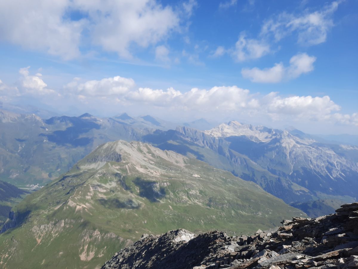
Pizzo Tambo is a fascinanting mountain peak right between Italy and Switzerland (but it belongs to Switzerland). It is sitting at breathtaking 3297 meters altitude in Lepontine Alps in the canton of Graubünden and opens up a wide mountain peaks panorama in Switzerland and Italy: amazing views to lakes and valleys are included.
Pizzo Tambo lies next to a famous Splügen Pass which has a strong historical meaning – it was a famous trading route in the centuries before now.
I have hiked up to Pizzo Tambo on one early August morning and fell instantly in love with the whole Pizzo Tambo region and Splügen Pass beauty.
The hike is for more experienced hikers and you are going to love this experience on the border of these Alps countries.
In this article I am going to write about these things:
- How to get to the starting point of Pizzo Tambo hike.
- Where to sleep?
- The whole hike report.
- Hike statistics.
- Pizzo Tambo hike map.
- What else to do after the hike.
Ok, so let us dive in into the hike of this beautiful peak.
Table of Contents
Short information about Pizzo Tambo hike
- Hike duration: up to 6 hours. Just to reach Pizzo Tambo you will need 3-4 hours. I was going quite slow, stopped many times, took pictures, I spent 3 hours.
- Hike distance: 8.6 kilometres (it can vary a bit depending on what paths you choose, all will be explained in the article).
- Difficulty: hard.
- Altitude difference: 1166 meters Ascent, 1166 Descent.
- Hiking path: mostly on the nature path and rocks. In the end the hike is very steep and you will kind of on mountain goat regime where you will even have to hike a bit up the rocks and even use your hands to get higher.
- Stuff to have: at least 4l of water for each person, good hiking shoes, cap (in summer time), enough food for 5-6 hours, hiking poles (it helped me a lot in the first part of the hike and walking through the snow), rain jacket.
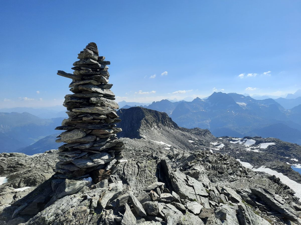
- Trail path marking: the path is pretty much UNMARKED, you will follow only some small man-made stone structures (small sculptures, stones laid one on each other). But mostly you have simply to go straight and in most parts the paths is very well seen. Then not – look for stones laid on each other.
- Time to do it: summer time (best from July to September). At such altitude the snow lies there for a big part of the year (I have crossed at least 3 big patches of snow).
Pizzo Tambo hike map
Let us have a look at the map below:
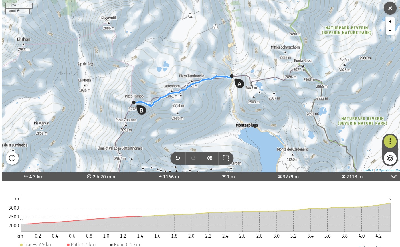
As you can see from the map, it is written that you can reach the peak in 2h 20 minutes, that is possible, but you will have to rush and push yourself. I was only at 3000 meters altitude after 2h 20 minutes. Here it is not very well seen, but in two places you will have to walk a bit down (maybe up to 20 meters). The hike is pretty much all the time just up up and up. In 4 kilometres distance you have to gain even 1166 meters in altitude, so be ready for a pretty intense physical activity.

The last part of the hike after the huge snow patch will be the most demanding as it goes up the rocky part. It can even be quite slipper sometimes (the rocks underneath you start to slip) and I have even saw some big rocks falling down to the snow from the mountain. I haven’t taken a helmet for this hike, haven’t seen any other person during all hike with a helmet, but I think, especially in worse weather conditions, it can be a good choice to have it.
Where to start the Pizzo Tambo hike?
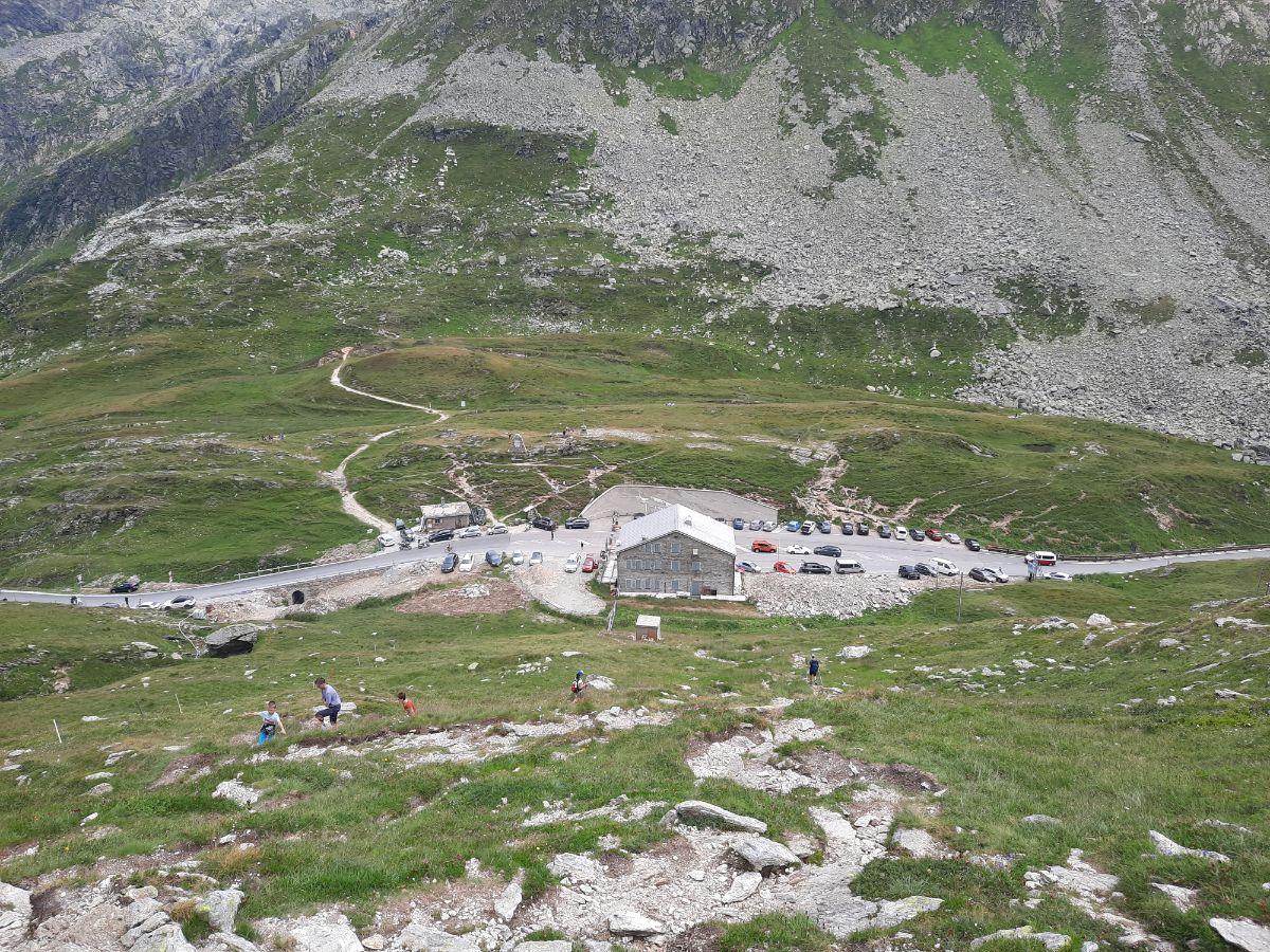
You will have to get to Splügen pass – the hike starts right on the top of this mountain pass.
You can easily get there with your car or by bus. Buses go there every day few times a day. Check all the bus connections right here: Swiss bus connections. Put Splügen Pass as your final destination.
If you go there by car from Zürich, it will take you around 2 hours to reach the starting point.
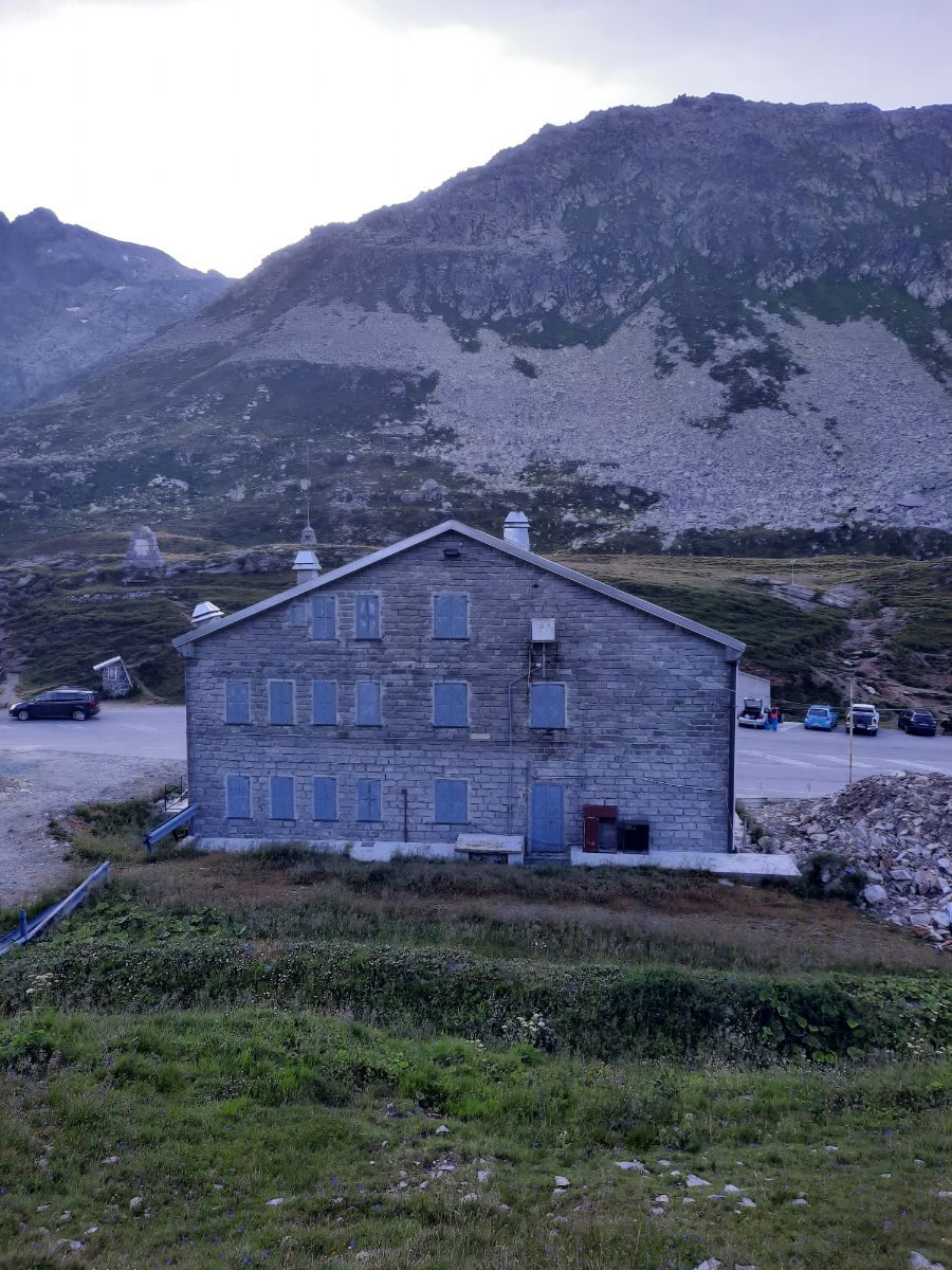
The border of Italy and Switzerland is right on the top and the hike starts right behind the big old border building.
I would really suggest to start the hike as early as possible, because weather there changes very fast.
I have started personally my hike at 7 AM (I have spent the night on the Splügen Pass in my car (there is a parking lot on the top)) while having a perfect weather, but after I finished my hike at around 2 PM it was raining with heavy winds (I have no idea how the hikers on the top lived through this kind of weather).
Pizzo Tambo hike
As mentioned before, the hike begins right behind the border house. I have started hike at 7 AM with quite many people (once I woke up at 6.30 AM, I saw that parking lot is full of cars and many many people are preparing for the hike).
The hiking path is not marked and you will actually see just one written sign right in the beginning.
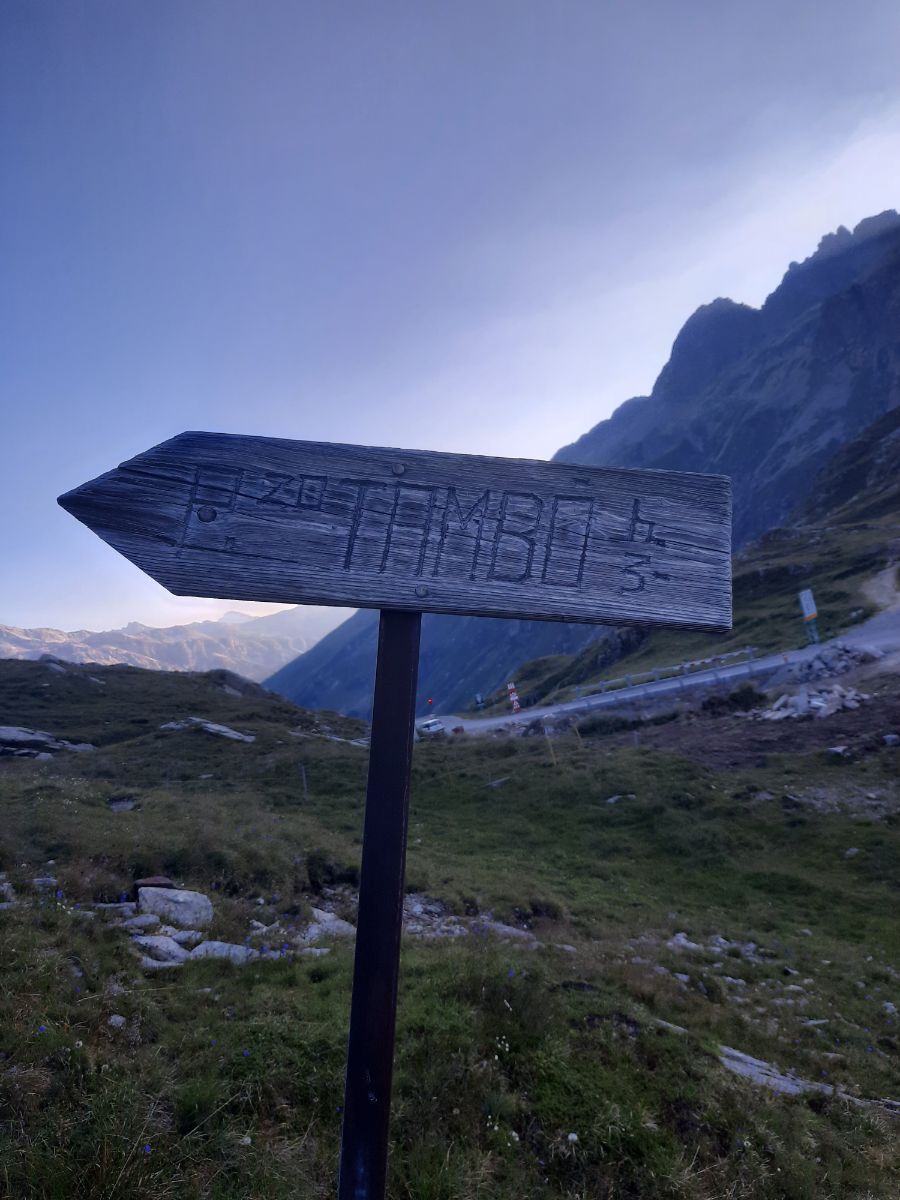
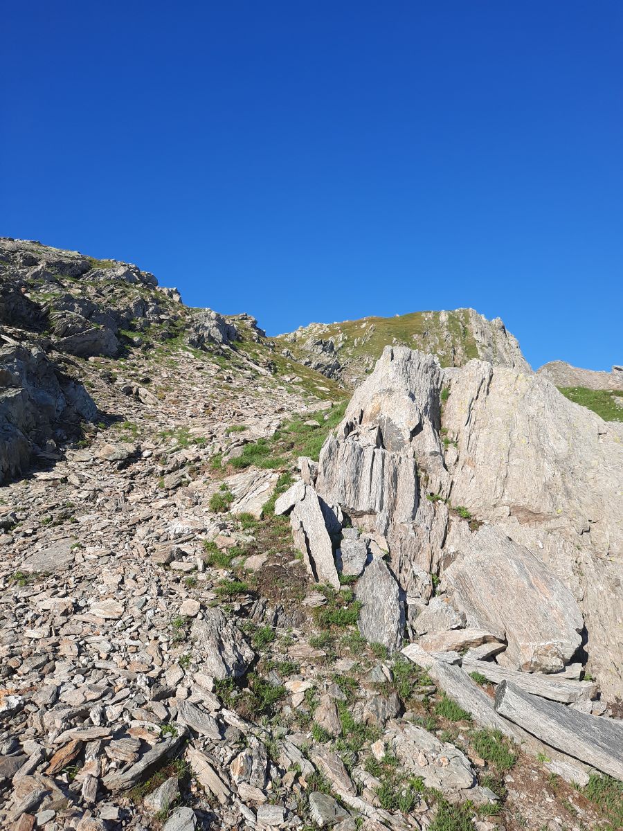
And that is it, afterwards you must follow the stone sculptures like the one below:
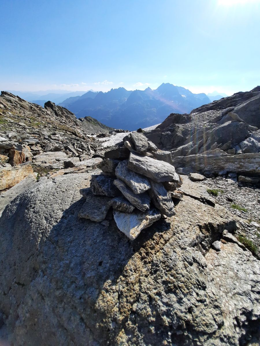
Some can be much smaller or even just one stone (mostly long stones laid upwards). If you see some stones laid unnaturally, it is probably the marking of the path.
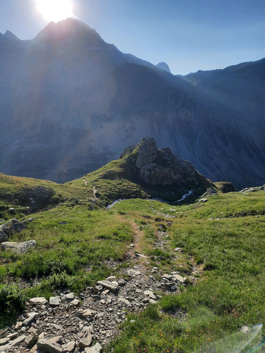
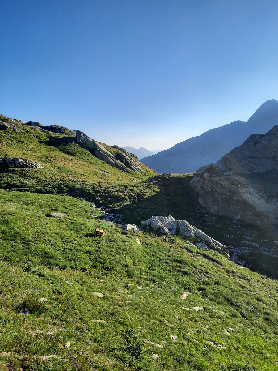
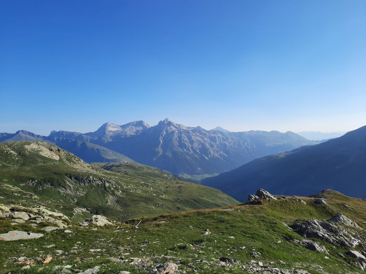
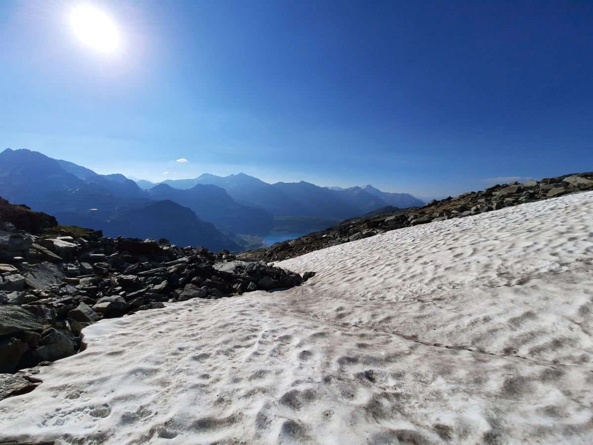
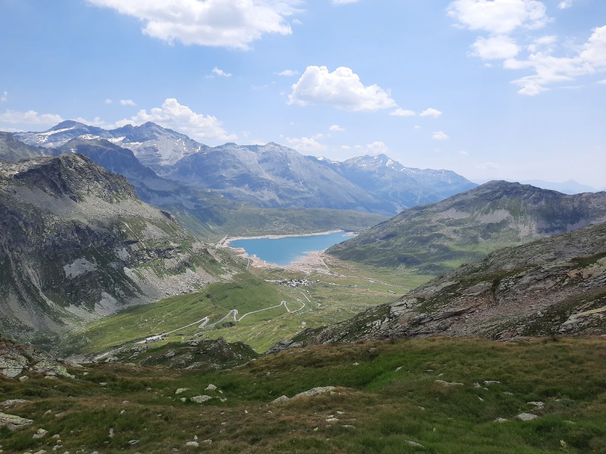
The hike is quite steep in the beginning, you will cross some grass patches, some snow, some rocks and an amazing view to the lake in Italy will open up.
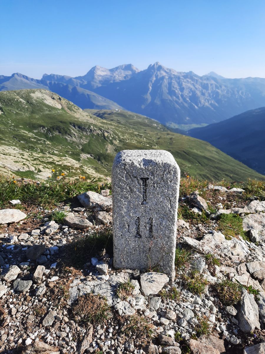
Here above you can see the border sign. All the hike you will be one leg in Italy, one leg in Switzerland.

You will see more and more of this lake while you will be hiking higher and higher.
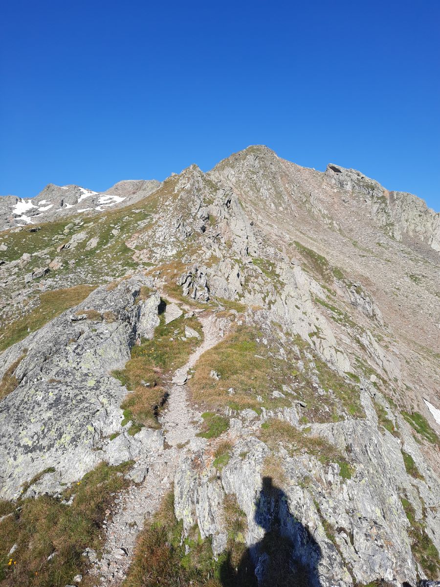
Here the rocky part of the hike begins and it will be similar to this till the end.
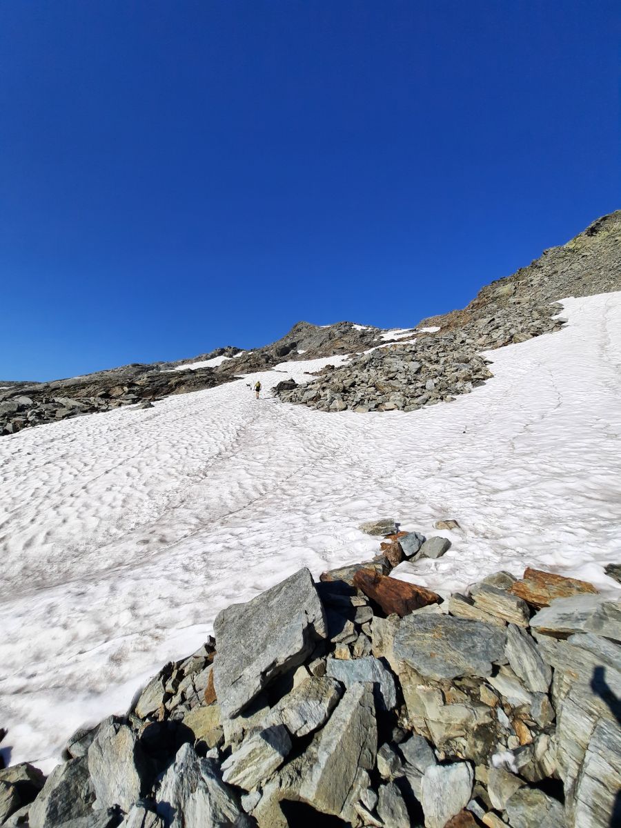
You will have to cross some snowy parts, but it is pretty save (a little slippery going down) if you have good hiking shoes and hiking poles. Snowshoes are not needed.
I can say that the hike is pretty demanding in under 2 hours I have finished my first bottle of 2l water, so I kept it slower on the second part of going up.
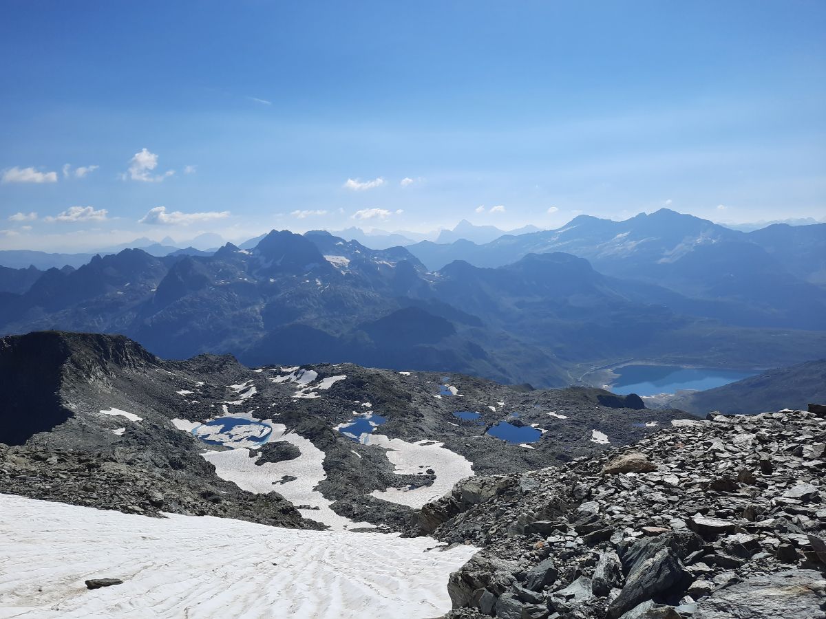
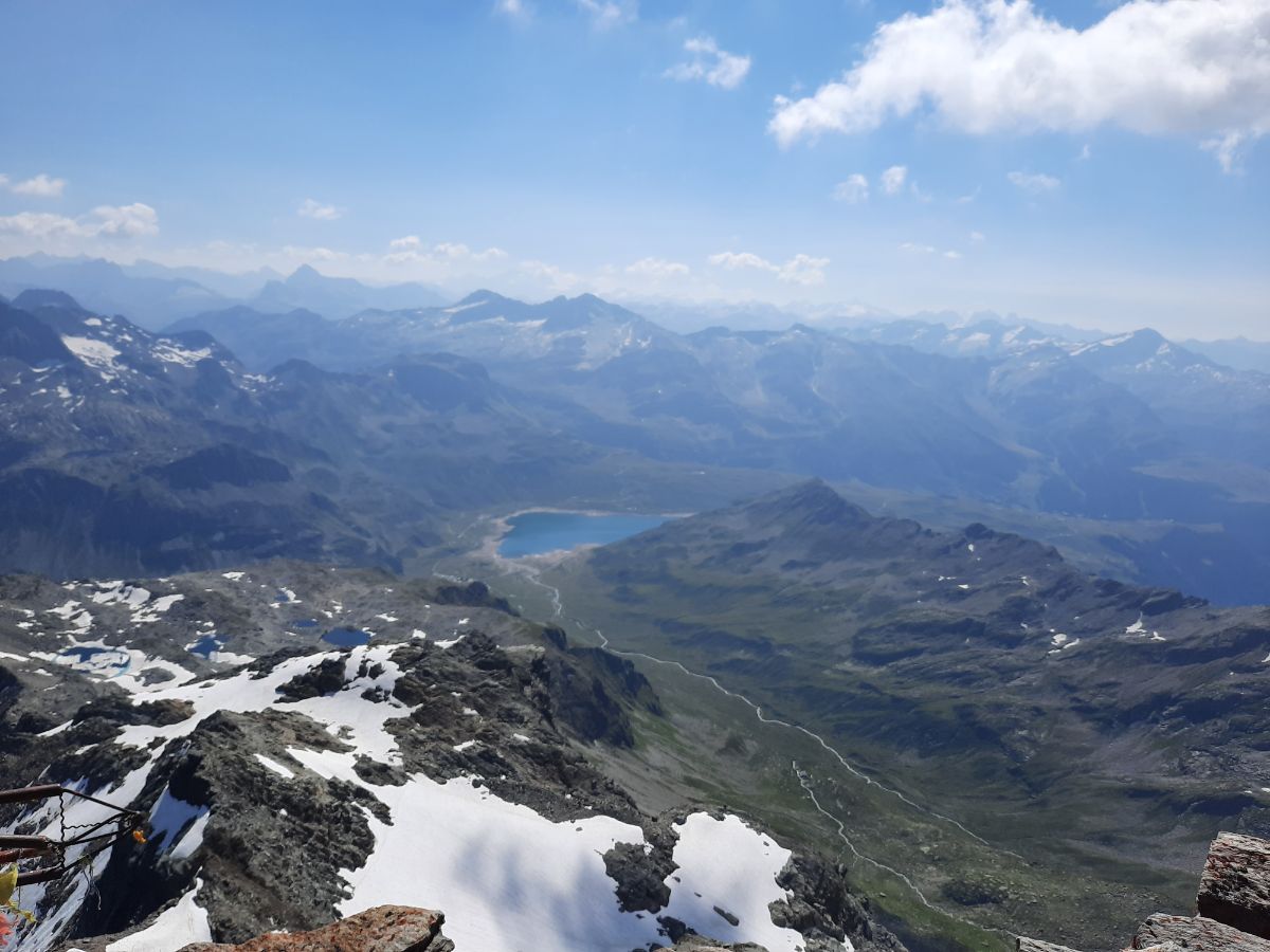
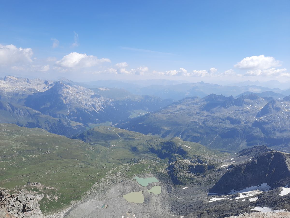
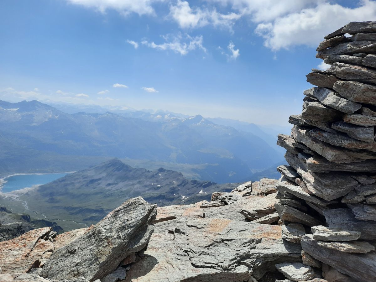
At the altitude of around 2770 meters you will see a very beautiful, half ice, half water, lake. It probably never gets fully water, it is a bit down below and if you have time and power, you can reach it in 10 minutes probably. A small detour. What was very surprising for me – I saw sheep! At that altitude. And there is now grass up there, just quite a bit below.
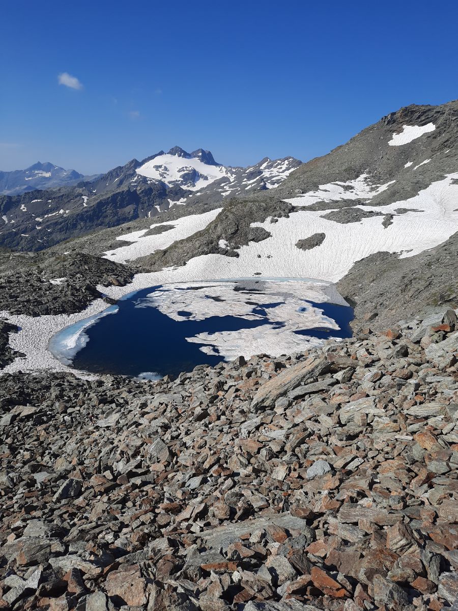
If you are crazy enough, you can jump into this lake, but it must be completely frozen.
You are going to see this lake all the time on your left and once you reach more rocky structures and will have to go up again (this stretch by the lake is the most flat in all the hike).
After the lake the hiking path can get a bit tricky and hard to see, but always take time and look for these stones with your eyes.
You will see sometimes quite many different small paths and take the one which you will think will be the easiest one for you.
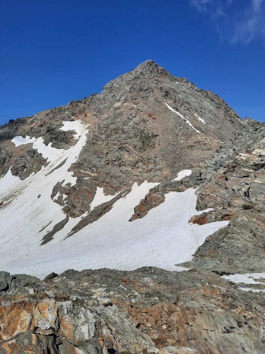
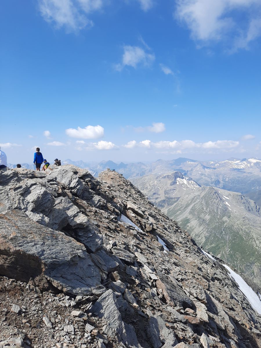
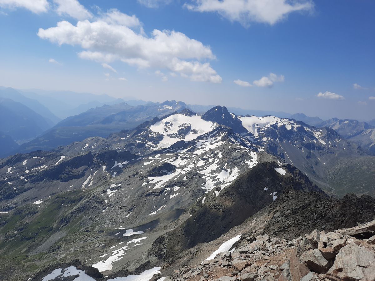
After you reach the altitude of 3000 meters (you may even think that it is Pizzo Tambo as a peak there has a cross on it), you will get to see the tremendous and scary big Pizzo Tambo. The whole rocky structure in front of you will be your goal and the whole hike is far from done. I have reached that point after 2h 20 minutes and to reach the top took me another 40 minutes. Actually you see the peak just when you reach 3000 meters altitude, before it is actually not seen.
You will have to walk a bit down and cross the snowy patch (it is the longest one on the hike). I saw some stones rolling down the snow, but not big ones. Still – keep attention.
Once you reach the base of the mountain, the hardest and steepest part of the hike begins.
Some parts can be very slippery (even though it is dry), because small stones just slip under the shoes. Sometimes even big stones are not very sturdy. Be aware where you put your legs. I had couple of unpleasant surprises.
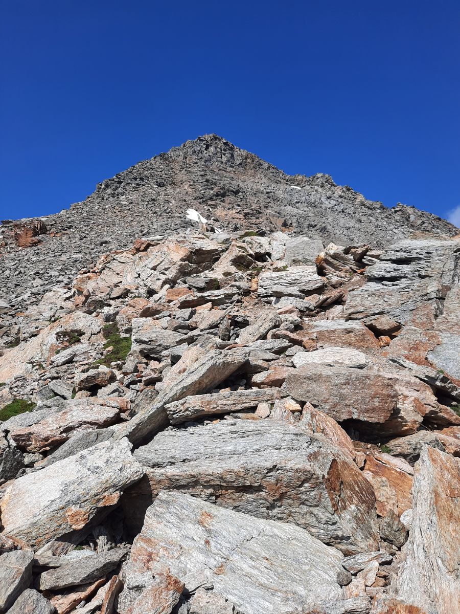
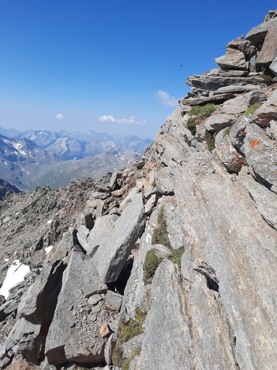
In some places you won’t even be able to walk up just with your legs, you will have to use your hands to lift yourself up.
I have met quite many people right on this last patch going down, so be careful while crossing each others paths. It is very steep up there and any fall can be very painful if not fatal.
The last 5-10 minutes are the steepest, but you can start to see the top which looks like an old dream. At that point you will really want to sit down and relax.
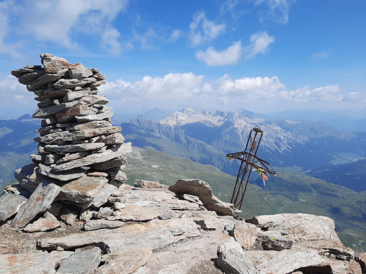
As I reached the top, I met probably 5-10 people already on the top – eating, talking, drinking, taking pictures.
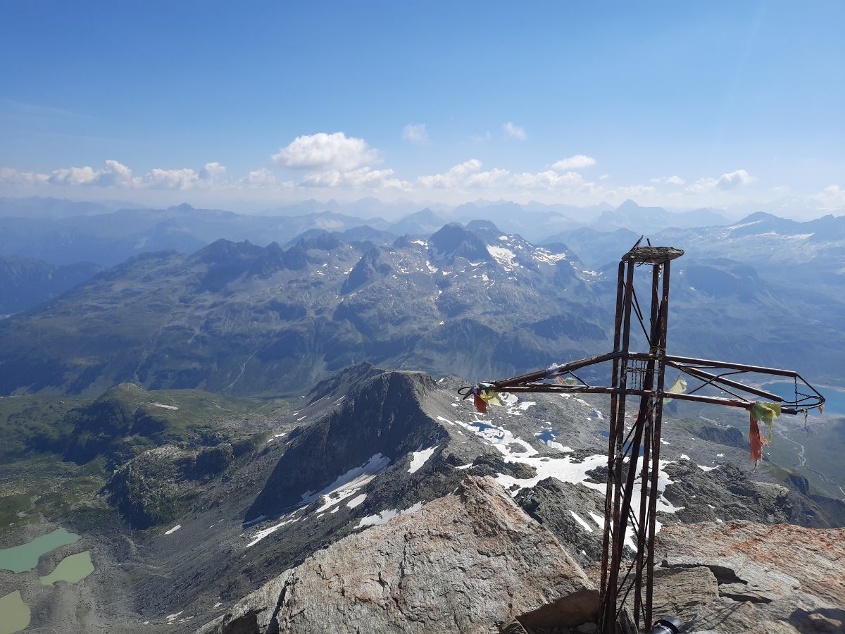
On the top you will find a cool poster with QR code which you can scan and put your information about the mountain, how you liked it and so on. I have done it 🙂
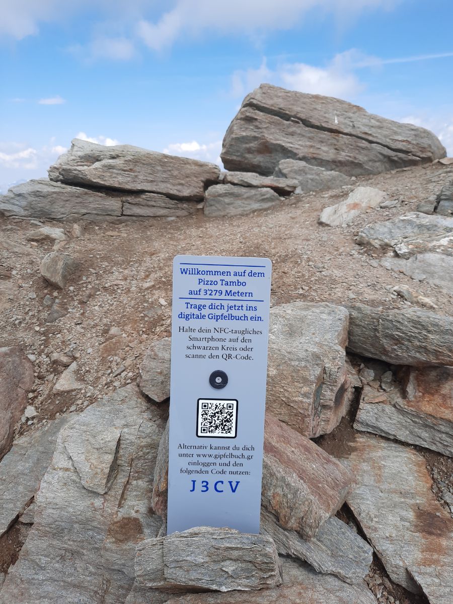
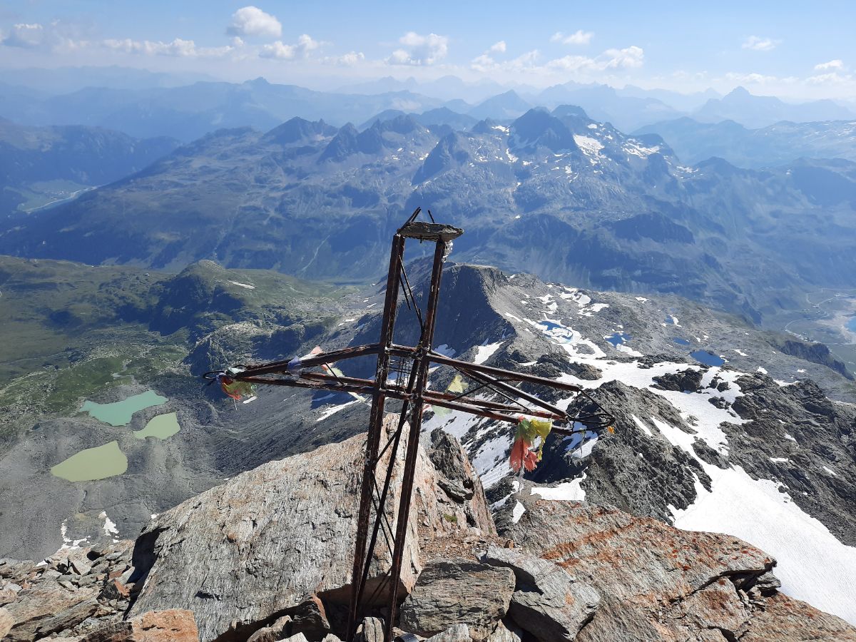
I sat myself right next to the cross which is overlooking all the peaks and relaxed for 20 minutes. Drank some water, ate some of my nuts and peaches and simply enjoyed the views. I really needed to rest a bit as the hike up is pretty demanding.
But the views… Amazing. Extraordinary. What was surprising for me, that at such altitude, it was completely calm. Zero wind. Just sunny nice weather.
After a good 20 minutes I started my hike down.
Pizzo Tambo – Splügen pass
On the first steep part from Pizzo Tambo it is very important to follow the hiking path (remember the stones), because otherwise you can get to dangerous slippery rock parts. Guess what? I got there. It was not fun at all and quite dangerous, I was jumping from some big rocks to another, so I wouldn’t get on these small slippery stones. Once you step on them, they begin to flow like a river. Not fun at all and if you lose control, you can go quite a long way down and break your bones.
So my advice, follow the path, do not get out of path on any part of the hike.
The hike down is much faster (I got down in 2h 15 minutes), but quite hard nonetheless, because it is very steep, rocky and your muscles are always tense.
I have finished all my water after 4 hours and the last hour was pretty hard as I was thirsty all the time. I took some water from the mountain streams, but I try not to overuse that water as it can sometimes be contaminated by animals (you just need a few bad bacteria to feel awful afterwards).
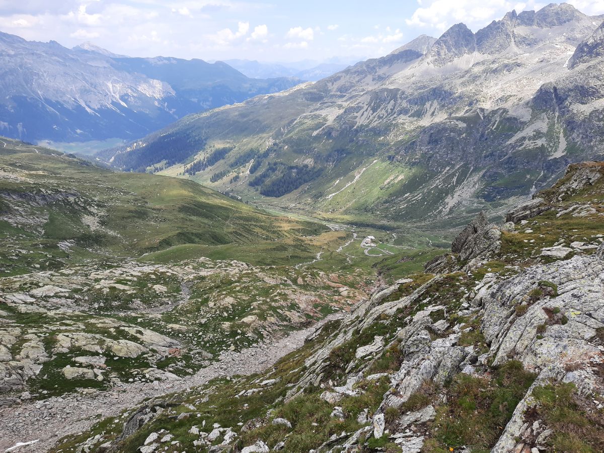
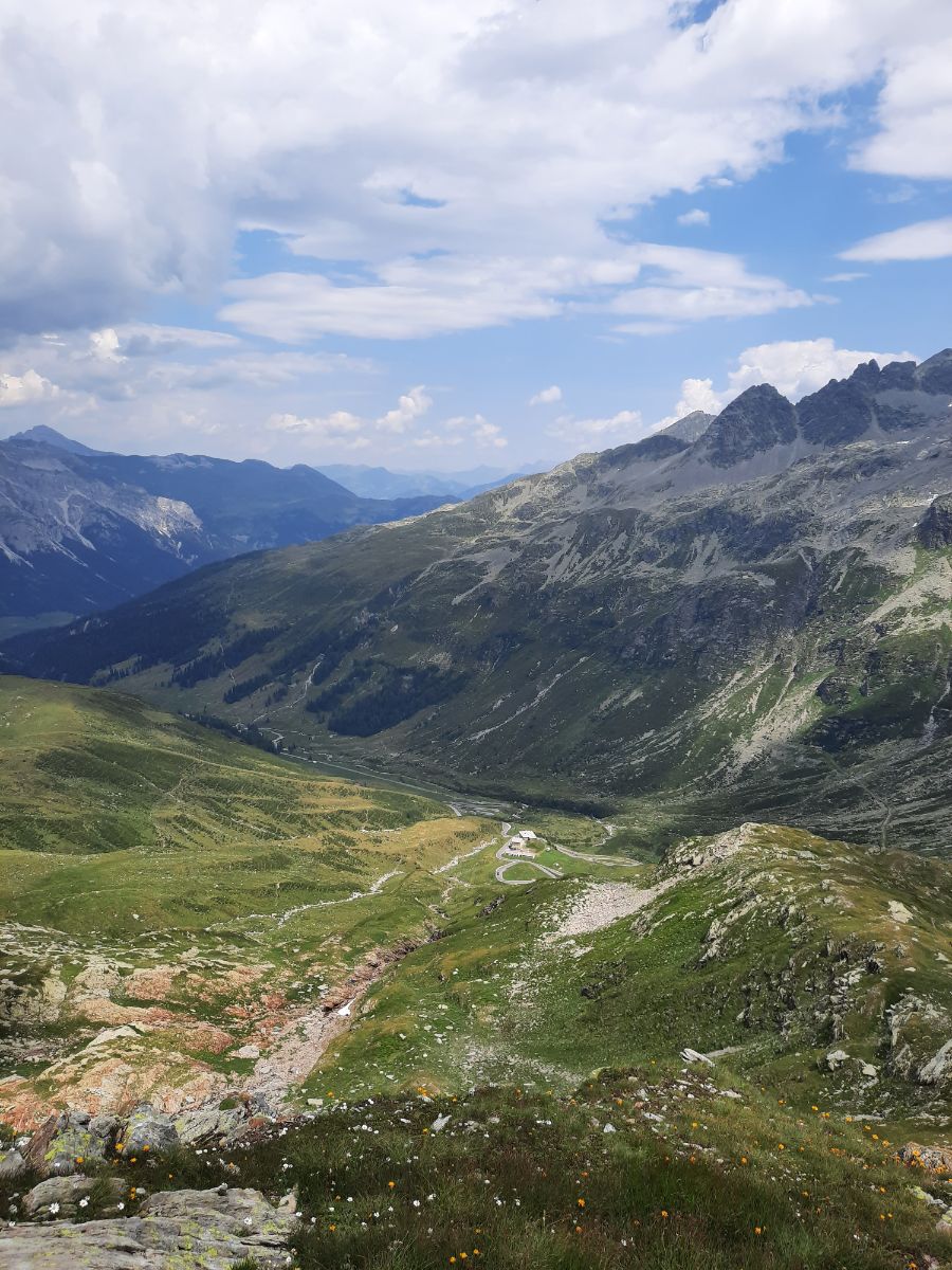
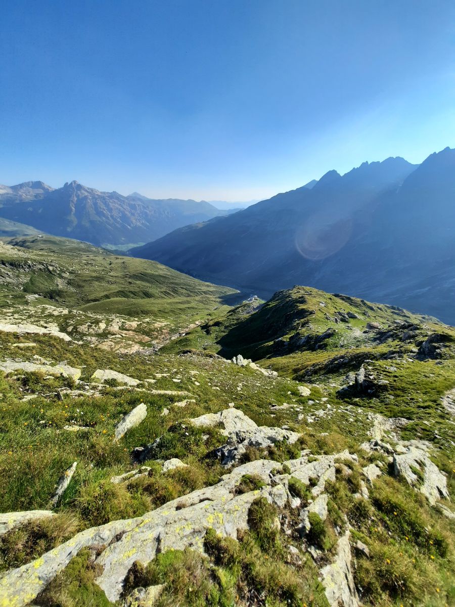
As I was going down, I enjoyed more views of the Splügen pass (pictures above) in the day time.
I have mentioned before that the snow is pretty slipper as you walk down – so I had a few not painful falls. Walk slow, use your hiking poles and pay attention to the snow.
As I reached the Splügen Pass (my car was there) I saw many many people. It is a popular destination and at the noon many locals and tourists travel through.
The whole hike: 5h 20 minutes. Memories – amazing. Tired? Yes. Have I drank a liter of water in 20 seconds once I opened my car? Yes.
Where to eat after the Pizzo Tambo hike?
You can find a restaurant just 2 minutes away (by car) on the Splügen pass with exclusive views and great local food. The name of the restaurant – Berghaus Splügenpass. You won’t miss it.
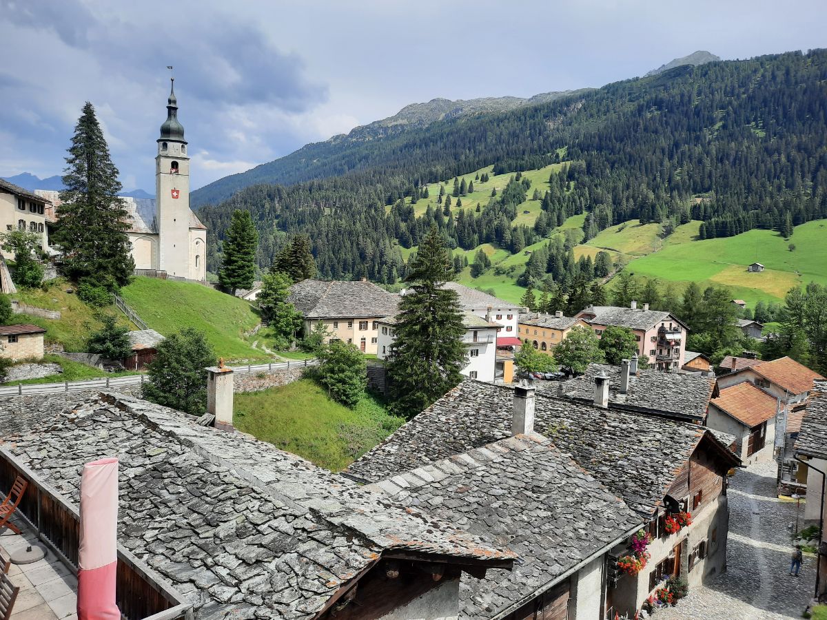
If you want more choices of food, you have two other options on both sides of the pass: you can go to Splügen. It is in Switzerland, a very nice cozy village with multiple restaurants and hotels.
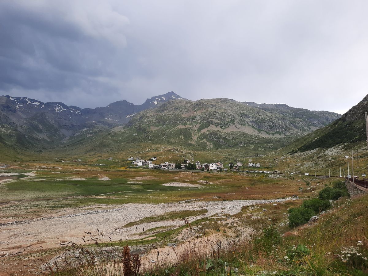
You see how the weather changed above Montespluga? It was minutes after I finished my hike. The people up in the mountain must have been in a bad mood. It was suddenly raining with strong winds.
Conclusion
Pizzo Tambo hike is an amazing experience in the amazing Lepontine Alps.
I have just couple of suggestions: be aware that it is a hard hike and you must be physically fit to do it. Otherwise you will be miserable or will have to come back in the middle of the hike. Other tips? Go there only on a sunny day and take plenty of water.
Have a great time on Pizzo Tambo!