Hiking in Sörenberg can be a really great summer experience in the Swiss Alps. I really loved it. The hike I did was pretty long and hard, but the views made it all worthwhile. On the top, it’s really nice and stunning. Ok, so let’s jump straight into it!
Table of Contents
Where is Sörenberg
Sörenberg is situated in Lucerne canton and it is in the middle of Thun and Lucerne cities.
Actually, Sörenberg is more known as a skiing resort. I have skied there two times, and I can say that it’s perfect for a one or two days skiing trip. It’s not very big, around 60 kilometers of slopes, but it has all you need: from the blue to black routes. Some black routes are extremely difficult, I didn’t even make one of those, had to go down like a beginner, slowly in one position, it was that hard for me. Of course, it was very icy on that black route and very steep, but once you see Swiss people almost flying there with no problems, you consider yourself not such a good snowboarder.
Ok, so some distances to Sörenberg from some bigger cities:
From Lucerne – 47 kilometers.
From Basel – 117 kilometers.
From Zürich – 100 kilometers.
It is pretty good situated in the middle of Switzerland.
How to Get to Sörenberg
If you are coming by car to Sörenberg, I highly recommend parking in Sörenberg-Schönenboden parking. It is at the end of the city, next to Sörenberg-Schönenboden cable car station. There is a huge parking lot. And you can start your hike right there.
If you would like to come to Sörenberg by public transport, you can easily do it with train and bus connections. Trains don’t go there, so the last stretch you will have to cover by bus. I recommend to get out at Sörenberg, Habchegg bus stop, as the Sörenberg-Schönenboden cable car station is right next to it. Check out all the latest schedules and prices right here.
Hiking from Sörenberg to Eisee
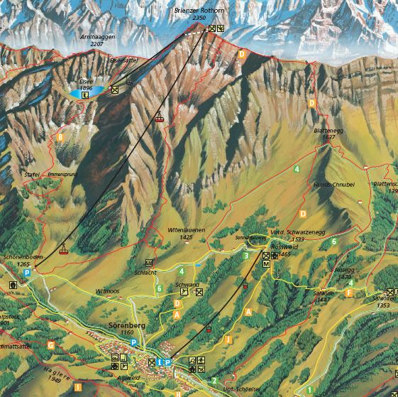
Once you reach the parking lot, you can start walking up right from there. Of course, you can use the cable car which can take you right to the top to Brienzer Rothorn which is at 2350 meters, but then you won’ really be able to see Eisee and all other stuff on the way, but if the time is pressing, you can definitely get up there with cable cars. The price to Brienzer Rothorn and back should cost you 40 CHF but check all the latest prices here.
Once you start to hike, head to the end of the parking lot where the cable car station is, behind it you will see those yellow direction arrows and there’s a path leading to the mountains. First – choose EISEE as your destination.
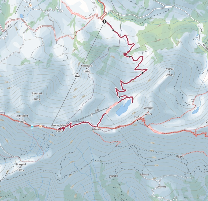
Have a look at all the Sörenberg hiking map and the map of our hike.
Ok, but first things first. This hike is pretty long, to Brienzer Rothorn you are going to need around 3-4 hours and you will gain more than one kilometer in elevation. So it’s not easy. I really suggest in the summertime to take: at least 2-3 liters of water for each; some food; a cap to save you from the sun; sunscreen; hiking poles if you have.
Once you leave the parking lot, the hike gets steeper after a few hundred meters once you go through one farm. If you are going there in summer, it can get really hot, so keep the pace slow, otherwise, you will want to stop by the Eisee.
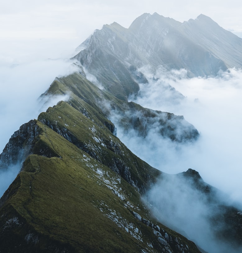
The first very beautiful sight you will reach on this hike is the before mentioned Swiss Alps lake called Eisee. It sits at 1900 m altitude. From there you will be able to see Brienzer Rothorn already, it looks very far from there.
If you want to rest by the Eisee, you can have a rest at Berghaus Eisee, this is a restaurant next to the lake.
Hike from Eisee to Brienzer Rothorn
From Eisee to Brienzer Rothorn you will have to gain more than 400 meters in elevation, but it’s maybe the most tiring phase of hiking.
Once I left Eisee, I met a lot of cows that are resting up there, at 2000 m elevation. But once you get a bit higher, the whole valley below you opens up. It’s a great place to have a little rest and take some pictures. The views are really amazing.
Once you start to push up the mountain, you will go next to the skiing place where people go down the red and black routes. The skiing place is closed in the summertime.
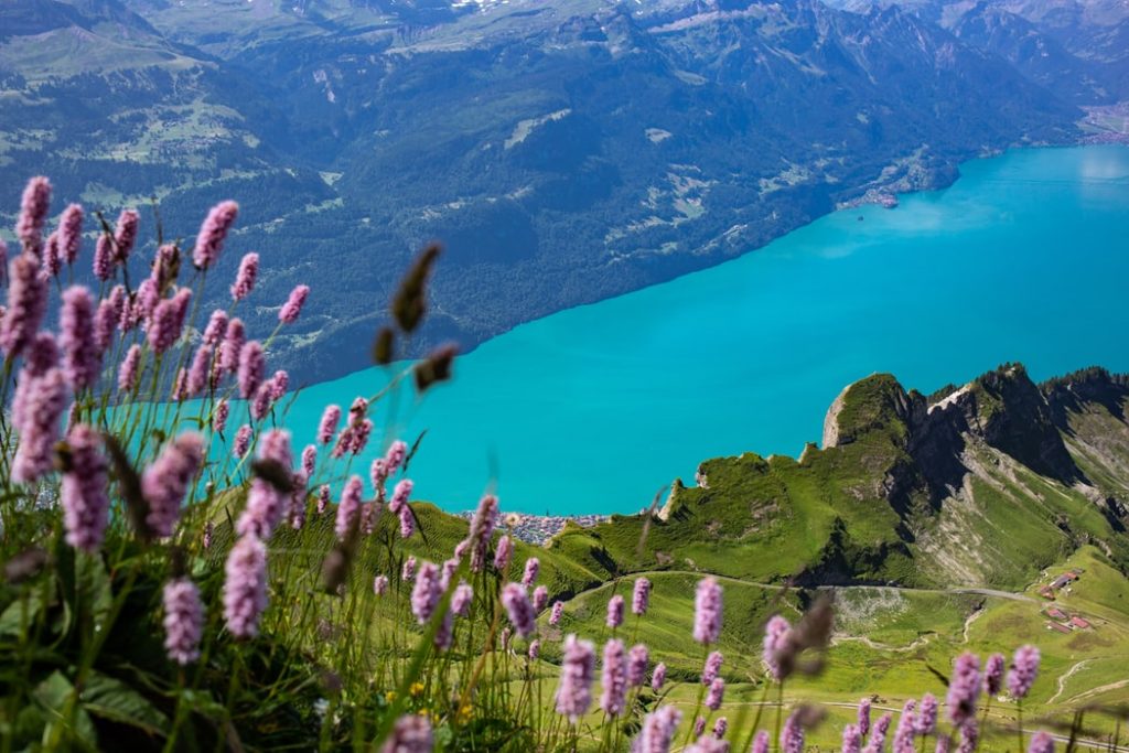
When I was hiking there in summer, I may be met 10-15 people hiking there, but on the top, there were maybe a hundred people. Simple: all of them use the cable car and can enjoy the views immediately, no need to hike 3 hours up. But on the top you feel like you deserve the views, deserve the rest, a very good feeling. The views of Brienzersee are amazing.
On the top of the mountain there’s couple of restaurants, a hotel and a shop, but I stopped by to buy a hot dog and some water. The hot dog was 7 CHF, but very delicious after such a hike.
After our lunch we decided that we would like to hike back down, do not take the cable car.
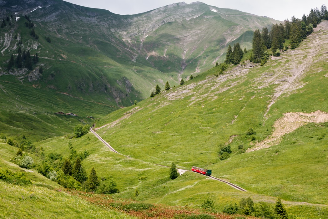
Once you reach the Brienzer Rothorn train station, there’s a path going down on the right. It’s just rocks, but you can actually see the path. You will see it in my video.
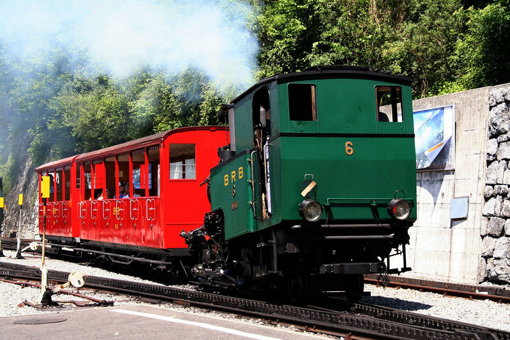
A note: you can get to Brienzer Rothorn peak by the cogwheel train from Brienz city. It is a pretty cool attraction as the steam train takes you up the mountain. And it’s a pretty long ride: about 1 hour.
Continuing on the hike: I do not really recommend going down that path as it is very very steep and rocky. It’s very easy to slip or sometimes even all the rocks underneath you start to slip. So go farther from each other so no rocks fall on your friends below. The First 10-15 minutes was pretty stressful. We even thought to take the path back up, but it’s so steep up there that just in a few minutes you get down quite a lot and looking back up looks painful – too much work. So we did that first stretch through the stones as slowly as possible.
Later on, we got some meadows, grass, and a loooot of sheep. Always nice to meet Swiss Alps animals. But still, all the hike down was pretty steep, it’s a faster way down, but more tiring as the joints are getting beaten all the time down.
Once we reach Sörenberg again, I am not going to lie, I was pretty tired. It was 5 hours hike where we got one kilometer up and down. That’s a lot.
I was very happy to get to the car, but I know one thing, I will come back there again in winter to do some snowboarding.
Hiking in Sörenberg – My Experience
Once I was doing this hike, I made this video of my all hike: you will see the Eisee, the Swiss cows, sheep, the dangerous path down, and the amazing views up there. I hope you like it!
Conclusion
Sörenberg offers a lot of hiking routes and the one to Brienzer Rothorn is really worth your time and sweat.
Just be aware that it is a pretty long hike so do no forget to take water and food with a very good sun protection.
If you do not wish to do all hike down, you can always take the cable car down, just be aware when it closes in summer as if you come later, it won’t be possible to go down, you will have to walk.
The views from Brienzer Rothorn to the white peaks and the lake makes this hike one of my favorites.
If you have any questions about the hike to Brienzer Rothorn, please let me know, I will do my best to help.