The Jungfrau region is popular for its wide variety of stunning hiking trails. One of the outstanding hiking trails in Bernese Oberland is the Eiger trail. The trail covers a wide area and you can hike from Eiger mountain to the North face area. Along the way, your sill gets to experience the stunning views of Grindelwald and all its surroundings. This is one of the most trekked hiking trails in the region. The views are stunning especially downhill watching to Grindelwald. If you decide to go up, the most beauty opens up in the looking to Lauterbrunnen valley and Kleine Scheidegg.
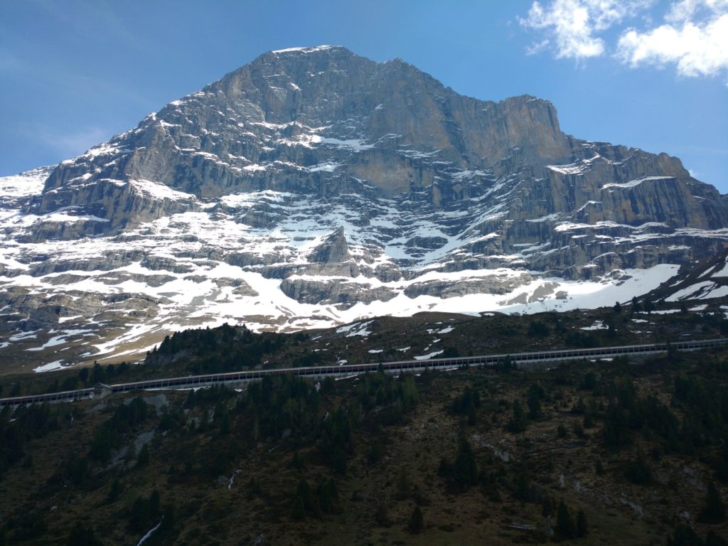
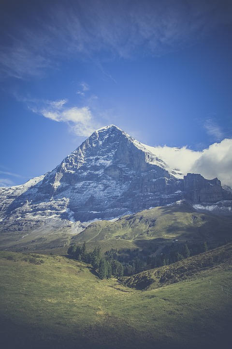
Eiger is a part of the main peaks of Bernese Oberland. We have Monch, Eiger, and Jungfrau all of which form the trio of mountains that are dominant in the area. The Jungfrau is the tallest standing at 4158 meters above sea level while Eiger stands at 3967 meters above sea level. Eiger is largely popular as a rock-climbing station. The North Face of Eiger mountain was first summited in 1938 by the Austrian climbing team. Since then many have tried, some have managed while others have failed. Hiking in the Eiger trail is an amazing opportunity for you to experience the Swiss alps from a different angle.
This time let’s cover the easier way: hiking down the Eiger trail. You do not have to be an experienced hiker or have any skills in hiking to trek the trail. Since it is a downhill trail you will not experience any difficulty while on the hike. Here are the facts that you need to know about the Eiger trail.
Distance of Eiger trail: 12-13 kilometers from point to point. BUT if you stop in Alpiglen (there’s a restaurant and train stop, hike is just around 7 km)
Elevation change: 1440 meters down and about 200 meters up. If you stop in Alpiglen: only around 800 meters.
Duration: 2 to 3 hours (depending if you stop in Alpiglen or continue to Grindelwald).
Difficulty level: easy to moderate. Most of the time it goes down, so just be safe and prepare to sustain some pressure on your joints.
Best time to visit: June through October. On other times it may be possible to do with snowshoes, but I suggest doing it in summer to have the best time.
Of course, it is possible to do the whole hike from the bottom to up, but then it is much harder and takes more time.
Table of Contents
How to Get to the Eiger trail
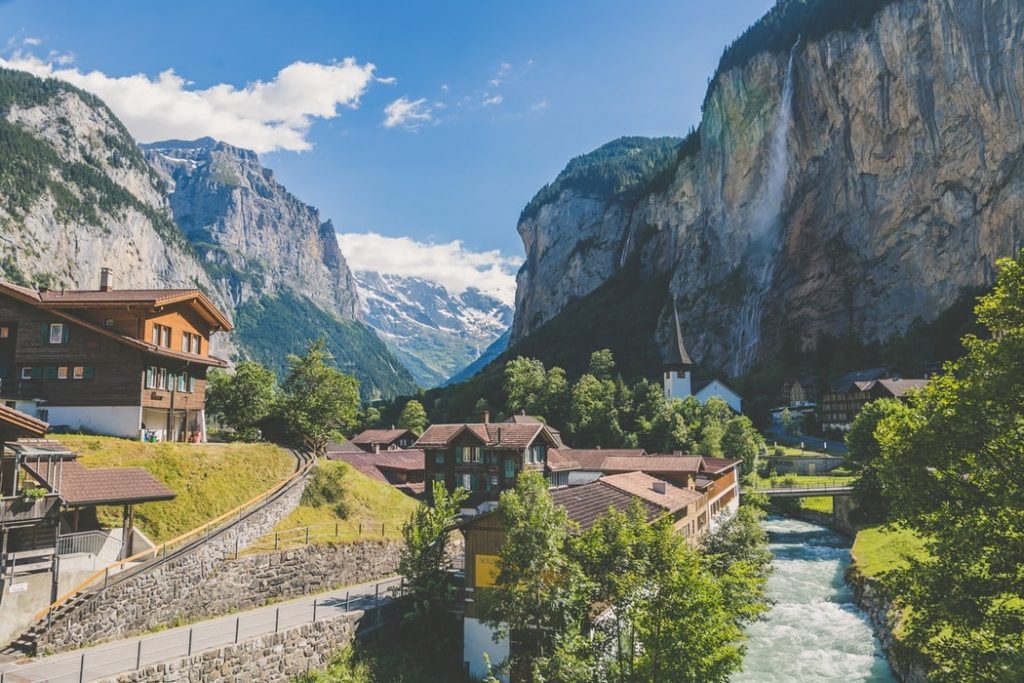
First of all, you need to get to Grindelwald. It is possible to get up there from Lauterbrunnen as well, but I think Grindelwald is a bit more comfortable.
If you come by car, you can park in Grund (it’s a village below Grindelwald). There’s a huge parking lot right next to Grund train station. You can get to starting point with a train and you can take that train in Grund. IF you would like to do Eiger trail the hard way, you can start in Grund as well. Simply choose Kleine Scheidegg direction and go up. After one hour once you reach Berghaus Alpiglen, there will be a direction to the left to Eiger trail 🙂
Grindelwald is easily reachable by train as well: you can check all the latest time tables, prices and departures right here: Swiss trains.
Eiger trail is located in the Jungfrau region as indicated before. The trail is categorized as a point to point hike and it begins at Eiger Glacier station ending in Berghaus Alpiglen, but I suggest you to continue right to Grindelwald, do not stop there 🙂 However, you can choose to hike the trail in any direction that you like from Alpiglen, Grindelwald or Grund to the Eiger glacier. Nonetheless, it is important to note that if you choose to hike uphill you will add 30 to 40 minutes to regular time because your speed will be lower and you will be moving against the gradient.
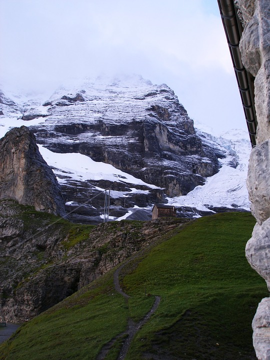
Eiger glacier station is situated between the Jungfraujoch and Kleine Scheidegg and to get to this trail you must first get to Kleine Scheidegg by train. You can get to Kleine Scheidegg from Lauterbrunnen, Grindelwald or Interlaken. If you are moving from Interlaken you will have to get a train to Lauterbrunnen or Grindelwald. Thereafter you can catch a train to Kleine Scheidegg. After Kleine Scheidegg you will need to get one more station up, to Eigergletscher train station. This station is right next to the tunnel to Jungfraujoch, this is the last stop where you can get out.
Costs that you must consider
- Lauterbrunnen to Interlaken or vice versa: time taken is 25 minutes, you will pay CHF 7.60 for one way.
- Interlaken to Grindelwald: The time taken will be 45 minutes and you will pay CHF 11.20 for one way.
- Lauterbrunnen to Kleine Scheidegg: time taken is 45 minutes and the cost associated is CJF 30.80 for one way.
- Grindelwald to Kleine Scheidegg: time taken 25 minutes and it will cost you CHF 31 for one way.
If you are coming from Interlaken then it is better if you go through Grindelwald to help you reduce costs. The common forms of transport include:
By train: you will get one-stop past Grindelwald on the train if you are coming from Interlaken.
By car: It is important that before you reach Grindelwald you will take the first right in the traffic circle to Grund where you will see signs on where to park. The parking space is metered and you have to display your ticket on your windshield. Besides, you can choose to purchase the Eiger trail hiking ticket which will cover fare from Alpiglen to Eiger and vice versa.
Once you have reached Kleine Scheidegg you will make a quick train ride to Eiger which usually takes 6 minutes and there are 2 trains per hour. The cost of the train is CHF 8 one way.
For all the latest prices and time schedules check the official Swiss trains website: Swiss trains.
Hiking the amazing Eiger trail
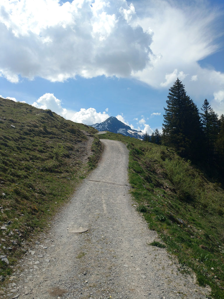
Eiger trail is one of the most amazing places to visit during your time in Switzerland. You should check local listings and information on the trail because there could be construction or repairs, but in summer time it is unlikely. However, the trail is well marked and it is easy to follow it. At the train station, you will see yellow signs that you can follow and access the trail with ease. Many people also hike the trail hence you will not get lost. Typically, the trail sign at the trail head indicates that it takes 2 hours to cover it. However, the time taken will depend on your speed during the hike. You can take as much time as you can so that you absorb the majestic Swiss nature. As well you may meet a lot of people going up to Eigergletscher from Grindelwald.
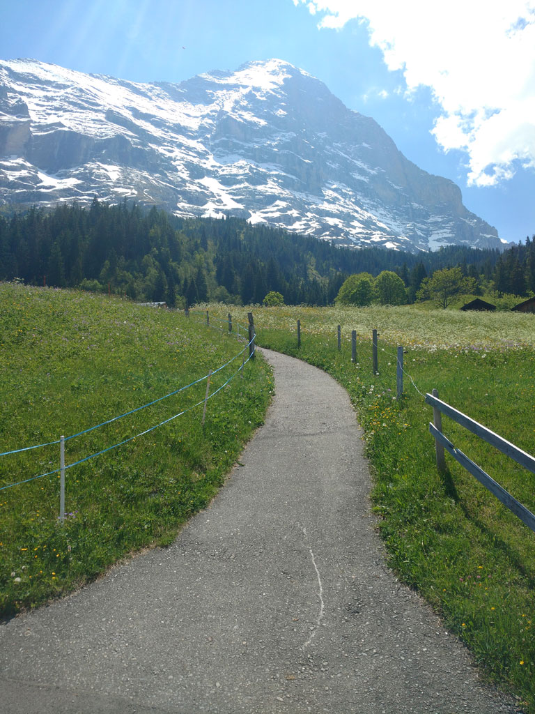
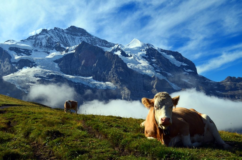
Along the way, you can see the Lauterbrunnen valley and the mountainous peaks. It is better if you hike on a clear day so that you can have a beautiful view of the valleys and Swiss alps. On a clear sky day, you will have the most amazing view and you can enjoy the breeze as you walk down the trail. Just before the trail begins you will make a turn toward Alpiglen and you will see a waterfall. Thereafter the trail zig zags as you head to Alpiglen. This is the toughest part of the hike because the trail loses elevation and if you have carried hiking poles this is the best place to use them. As well, the hike consists a lot of rocky trail, so be with good trail shoes, so you won’t slip. The trail ends in Alpiglen and there is a tiny restaurant there where you can get foods and drinks before you continue with your journey. You can either take the train back to Kleine Scheidegg or hike to Grindelwald. It is around 1 hour from Alpiglen.
In Alpiglen coffee should cost you around 6 CHF, dinner around 20 CHF.
What you need to have during the Eiger hike
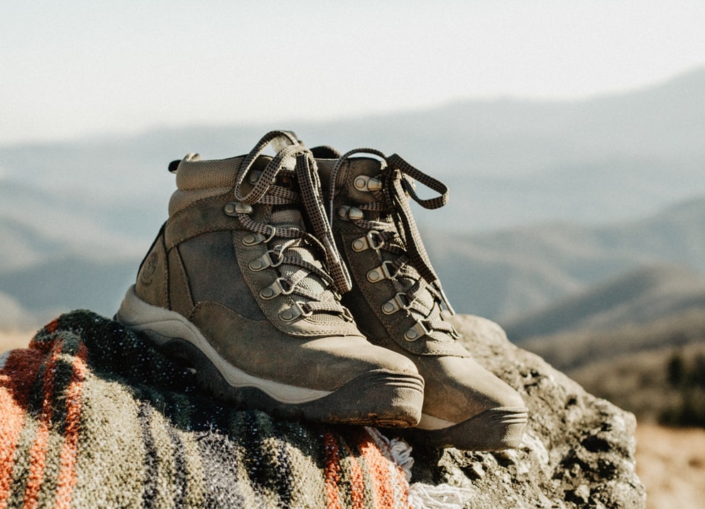
There are items that you should not miss if you want to have the most amazing hike. You will need hiking shoes especially waterproof shoes during the wet seasons. You must carry water and food although you can schedule your hike to include eating at the restaurant in the trail.
If you choose to go up Eiger trail, not down, I would recommend to have at least 2 liters of water for each. Hiking poles as well will help a lot as it is a pretty steep hike and very rocky.
Once you leave Eiger trail from Eigergletscher station to Alpiglen or the other way, there’s no places to eat, so have some snacks on you.
The hike is pretty steep and rocky, so just to be safe, check out all the Swiss Alps hiking tips I prepared 🙂
If you take your time, take it easy, you are going to love the Eiger trail. The views are stunning. Nature changes from grass to rocks, very nice transition. And all the way, next to you, you will see the huge Eiger mountain face.
Conclusion
Eiger trail is doable for everyone. Especially if you choose to go down from the top. Then it’s not that hard, very pleasurable and moderate hike. It is perfect for lonely hikers and for families.
I highly suggest going there in mid summer, so there’s highest chance of good and sunny weather, not cloudy, best views just for you.
After you finish the hike, do not forget to take Swiss fondue and relax 🙂
If you fall in love with this hike, I have more for you right in Grindelwald and Lauterbrunnen!
Do not forget to follow me:
Instagram: @golookexplore
Facebook: golookexplore
Youtube: golookexplore
Pinterest: golookexplore